West Clear Creek Wilderness is located just east of Camp Verde in northern Arizona. It's often trumped in popularity to the smaller wilderness areas that sit directly north (Wet Beaver Wilderness) and to it's south (Fossil Springs Wilderness) that are more accessible to the public. West Clear Creek drains a large portion of the 200 mile long Mogollon Rim. The wilderness area runs the length of the creek's canyon for approximately 20 miles, but rarely spans more than a mile across. The US Forest Service dubs this canyon as one of the most rugged and remote canyons in northern Arizona...that's saying a lot since the Grand Canyon is also found in northern AZ. The West Clear Creek Canyon is punctuated with towering cliffs that rise 1,000' to 1,500' from its valley floor. Due to this dramatic change in topography and east-west canyon orientation one can find very diverse ecosystems in very close proximity. The perennial stream bottom gives life to cottonwood, willow, wild grape, walnut, sycamore, and my favorite, poison ivy while the slopes above give way to juniper, pinion, mesquite, catclaw, hackberry, scrub oak, ocotillo, and prickly pear.
Conveniently, the West Clear Creek Trail enters the western end of the wilderness area and follows the fast flowing stream for almost six miles before leaving the gorge bottom and climbing to the rim above. By using Forest Service Road 214 (Cedar Flat Road) and the Blodgett Basin Trail a very scenic 14-mile loop can be made experiencing all the intimate layers this wildness provides. Here's a photo tour of that epic loop.

A carpet of desert marigolds in bloom.
A map of this loop and its surrounding area.

Single track and sycamores.

West Clear Creek rolls over red sandstone.

The trail meanders through the riparian area.

A ribbon of green in the desert.

The upper slopes.

A river runs through it. Crossing it four times was a definite highlight!

Cliffs of color.

Looking down into West Clear Creek from above.
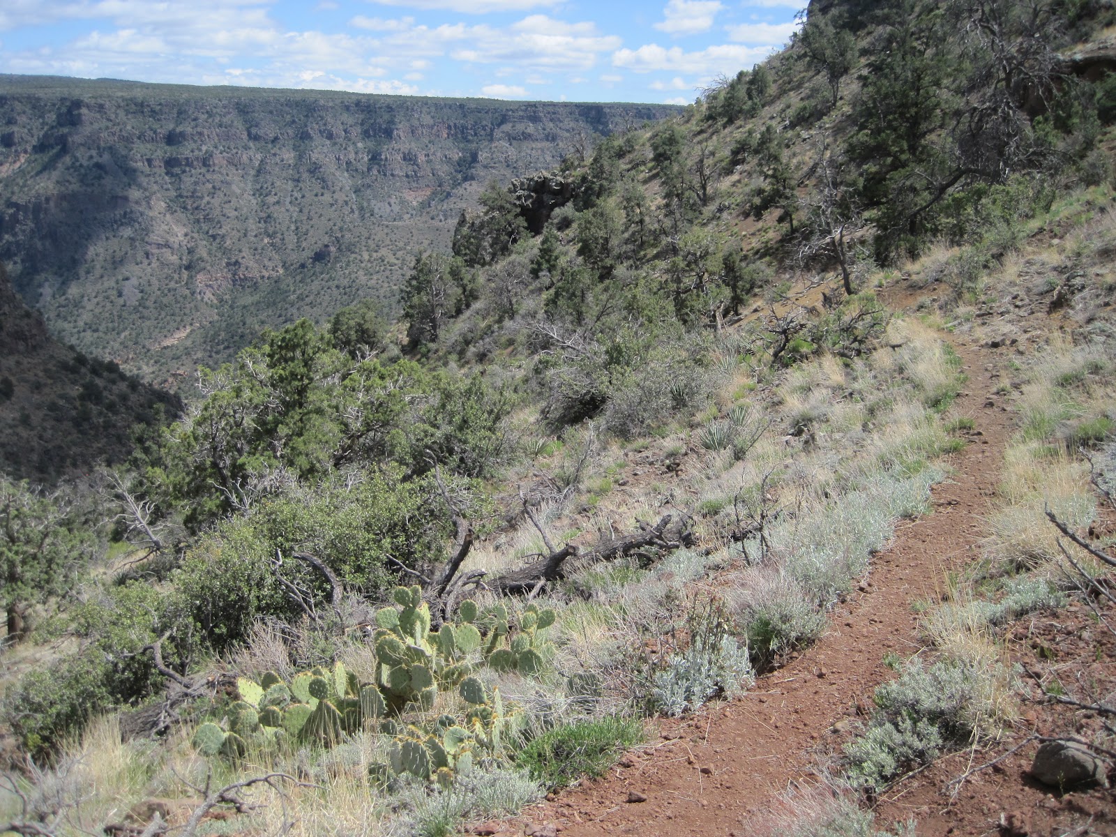
Single track on the rim.

Zoroaster takes a break on Forest Road 214.

Running the road above the rim.

Blodgett Basin Trailhead and target practice.

Descending back into West Clear Creek Canyon.

Another view of the green river from Blodgett Basin.

Ocotillo in bloom and the "mouth" of West Clear Creek Canyon.
Your Moment of Zen

After a run like that Zoroaster agrees, "It's time for bed!"
5 comments:
very cool loop!
Nice photographs, as always! Beautiful places...
Nice photos man. Looks like a nice loop and the river crossings looked fun. Good luck this weekend.
Heya awesome scenery so jealous!
i miss arizona.
I love the wet beaver loop following apache maid trail, then scramble down waldrop canyon, then creek walk/swim back to the parking lot via wet beaver creek canyon. classic.
Post a Comment