Its a Flagstaff classic. One of my favorite running loops in Flagstaff takes you around, up, over and down the San Francisco Peaks. You get a little bit of everything and see it all. The loop is almost 19 miles long, reaches 12,000' above sea level and gains 4,000 feet in elevation. Couple this with a bunch of friends and you have the ingredients for a great morning's jaunt!

The Peaks as seen from Baderville.

The Crew: (left to right) Eric Bohn, Josh Brimhall, Shad Mickelberry, Trent Briney, Andrew Middleton and Zoroaster (down in front).
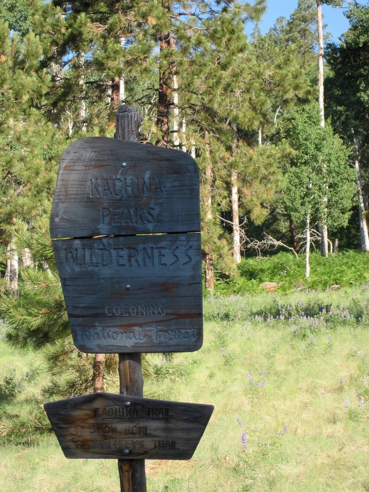
The Boundary to the Kachina Peaks Wilderness Area

Shad and Zoroaster make tracks on the Kachina Trail.

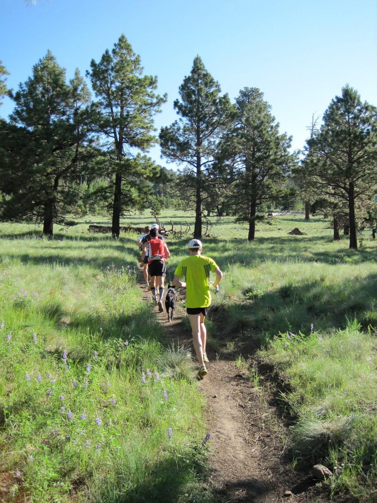
Middle (in yellow) and Briney run through one of many meadows on the Kachina Trail.

Early morning sun shines through the aspens.

Middle and Z part an aspen grove.

The Kachina Trail is known for its huge fern fields. Here middle and Zoroaster blend in.
Leaving the Kachina Trail behind, we start up the Weatherford Trail.

The Weatherford Trail was built in the 1920's. The now closed roadbed served as scenic access for many Model-T Fords.

Shad nears Fremont Saddle.

Briney, Middle and Bohn gather themselves at Fremont Saddle. Our trail will lead us to the pass located just above Bohn's head.

The Weatherford Trail continues to traverse mountainous slopes.

Now at near 12,000' feet even the nearly level trail becomes difficult.

Looking back at Fremont Saddle (just left of center) with the Inner Basin between.

Briney and Middle start the five-mile descent as northern Arizona spreads out below.

Down into the saddle between Agassiz Peak and Humphrey's Peak.
12 comments:
Great trail. Looks like loads of fun.
Awesome loop...I was up there last weekend to do the same, but turned around at the intersection of Kachina/Weatherford because of trail closure signs (due to the fire). Are the trails reopened?
Weatherford and Sunset Trails are now open, as of last Thursday:
http://www.fs.fed.us/r3/coconino/news/2010/2010-07-14-schultz-closure.shtml
We ran by the same sign. I suspect they forgot about it, due to it's remoteness?
Ian
Thanks Ian, heading up Sat for the same route, is Shultz tank parking lot open? Did Kendrick last weekend, that was a good option, kendrick, pumpkin, connectot, bull basin, kendrick back down. Glad to see it is re-opened.
I believe Schultz Tank parking is open (we started at Snowbowl). We saw runners coming up from there. If not, then the Sunset Trailhead (a half-mile away) is for sure open (saw cars there yesterday as I ran by). You can only get a vehicle in via Schultz Creek Road off of 180 right now. Elden Springs Road is still closed (off of 89).
Wish I could've been there. Although I was doing cycling repeats on Snowbowl that day, I'll have to wait for another time to do the loop... gotta get this damn achilles and calf healthy.
Very much looking forward to joining in next time.
Great photos as always Ian. That was definitely the highlight of my summer so far. Thanks
Great write up Ian. What are the trails & directions for the loop? Starting from snowbowl, where should I go from there?
Brian,
If you start at the Snowbowl (I like going CCW) and the Kachina TH this is how it runs: Kachina Trail for ~5 miles, to the Weatherford Trail for ~5 miles to Fremont Saddle, then ~2 miles to Doyle Saddle then ~2 miles to Humphrey's Saddle, then you have the option of summiting Humphrey's (2 mile round trip) or heading back to your car on the Humphrey's Trail ~5 miles.
Here's my Garmin Data for the run:
http://connect.garmin.com/activity/40905805
Have fun!
Ian
Great pics. Going to head up there tomorrow. Safe Travels.
I enjoy the blog, makes me glad I'm moving to Flag in a couple weeks. Don't think we've met since I rarely race out of Utah but hopefully I'll see you out on the trails soon!
Post a Comment