Not often do you get the chance to assist a friend in need in a place like this.
On short notice, I discovered that my very good friend,
Hal Koerner, was heading to Colorado to take part in the
Leadville Trail 100 Mile Run. It was a last minute decision on his part in order to carry on his own tradition of consecutive years with a 100-mile finish. I believe he has eleven and counting.
Leadville has always been one of those "sweet and sour" races for Hal. He's placed second overall twice, but also has dropped several times. This year, he was returning but without a crew or pacer. I offered to help, if only he'd buy my plane ticket. He did so and we were on our way!
The mountains of central Colorado. Where the blue is very blue, the green is very green and the mountains literally take your breath away.
3am, race day morning. As Hal readied himself I caught an episode of "Are You Smarter Than a Fifth Grader." At that hour, I quickly discovered that I was not.
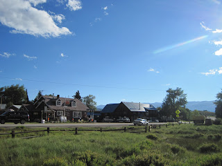
We parked down the street and away from the start line hub-bub. Walking down the middle of Harrison Street at 3:50am as gun-toting outlaws must have done years ago.
The crowd, nearly 650 strong, minutes before the start.
May Queen Aid Station (mile 13.5) in the pre-dawn hours.
Jamil (right) and Nick (left) Coury await their runners at May Queen. Yes, it was cold!
The sun rises at the Fish Hatchery Aid Station (mile 23.5).
Hal on his way out of Fish Hatchery and on Tony's heels.
The Treeline Aid Station (mile 28). I was unsure I was in the right place. Only one other parked car was there.
Tony whips through Treeline.
Hal follows a few minutes back.
The setting for the Twin Lake Aid Station (mile 39.5).
Tony doesn't stop, passing quickly through the Twin Lakes AS.
Tony doesn't break stride while receiving assistance from his confidant and lady friend, Jocelyn Jenks, and pacer, Dakota Jones.
Duncan Callahan, of Gunnison, CO, passes through Twin Lakes. No one knew it at the time, but Duncan would become your 2010 Leadville Champion in 17:43:24.
Good friend Jason Ostrom (in the blue).
Bend, Oregon's Rod Bien. Finished in 19:46:03, 9th overall
Motivating Hal after he became lost twice between Box Canyon and Twin Lakes aid stations; setting him back more than an hour and dropping his placing from 2nd to near 45th. I felt, the wind in the sails was gone at this point, but he forged on.
Winfield Aid Station (mile 50) and turn around. Now it's time to flip it and retrace your steps back to Leadville and the finish.
Jess Koerner helps her brother at Winfield. I started pacing Hal here.
On our way up to Hope Pass (12,526').
Mike Arnstein (finished in 22:48:44) shows his muscle on the climb up Hope. Nick Coury, his pacer, follows. Behind the two, Hal continues to climb.
Flagstaff's Adam Wymore descending to Winfield. Adam would finish in 28:53:05. Jay Donosky, also from Flag, would finish in 29:10:09. Nice work gentlemen!
One foot in front of the other, still ascending Hope Pass.
Looking down from Hope towards where we had come. Awesome country!
Finally there, but the altitude reeks havoc.
Hope Pass Aid Station (mile 56), set roughly 600' below the actual pass.
Another view of the oxygen deprived aid station.
Hal collects himself at the Hope Pass Aid Station.
Llamas bring in all the supplies for this aid station.
Finally down off of Hope and moving well across the flats to Twin Lakes In-Bound.
Crossing Lake Creek and the lowest point on the course at 9,200'.
Changing shoes at Twin Lakes AS (mile 60.5).
Running under the aspens on the Colorado Trail, near the Mount Elbert Trailhead.
On the new section of trail near the Box Canyon Aid Station.
Quiet and quaint Box Canyon Aid Station (roughly mile 68).
Hal, again, collecting himself and trying to bring life back to trashed legs.
Frustrated with his bad ankle and muscles that didn't want to move, we walked down to Treeline.
Hal still smiling even after all these miles.
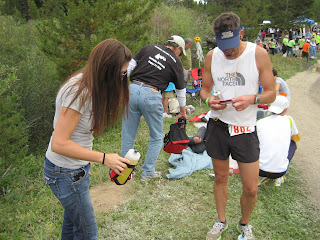
At Treeline (mile 72), Hal got on his phone and discussed his predicament with his fiance, Carly. After some deliberation Hal reluctantly pressed on-ward. We walked the next 4.5 miles under a setting sun and rising moon to the Fish Hatchery Aid Station (mile 76) where Hal called it a day.
Finally back at our hotel room at 11pm, Hal smiles, perhaps somewhat sheepishly. Knowing Hal, he won't beat himself up over his decision to stop at Leadville. In fact, he always moves on rather quickly from disappoints like this. Knowing this guy, he's already looking forward to bigger and better things this upcoming weekend, like a grand ole wedding! Though the outcome was not what either of us wanted, I still had a good time and shared some quality trail time with Mr. Koerner.
My Other Random Leadville Thoughts...
Leadville has clearly out grown it's infrastructure. 650 runners is just too much for this course. That's a fact, not a hypothesis! Let's discuss the forest health and safety aspects of the event. The trail up and down Hope Pass was literally a conga line of runners forcing many runners into the fragile alpine ecosystem in order to pass one another, crushing all kinds of wild flowers, forming social trails and sending rocks and debris downslope. Many did their part in trying to mitigate the litter problem, but there were a lot of piggies out there. The access roads into all aid stations were a cluster: Miles of crew and pacer vehicles parked along roadsides that simply could not and should not sustain such crowds. Winfield looked more like a summer music festival than an aid station. In many places runners and crew/pacer vehicles ran concurrent causing unsafe, dusty, and in my opinion, creating an uncharacteristic ultrarunning experience. Drivers ran stop signs, passed on windy, single lane dirt roads and developed a habit of presenting the middle finger to others traveling just a wee bit too slow for their liking. You could say, "Fine, Torrence, if you don't like it, then don't return." All well and good, but the truth of the matter is that I believe, in this case, we may have forgotten our roots, gotten too excited about a particular book and succumbed to the commercialization of our sport. In other words, we may have just sold out.
On the flip side, when not dodging cars and runners, I received nothing but care, attentiveness and great comfort from all the volunteers, radio operators and aid station staff. It was also great to catch up with friends both new and old and help out a good friend. The scenery at Leadville can't be beat!
And Now Your Moment of Zen
The Second Annual Running of the Rogue Valley Beer Mile
Coaching Tip: Do Not Try This at Home!!!


